Main map Feature: hgt grid layer
The hgt layer is a special grid layer with a constant spacing of 1.0, so it shows the grid of full latitude an longitude degrees. The special thing about this layer is that it shows the availability of the height data, e.g. like this
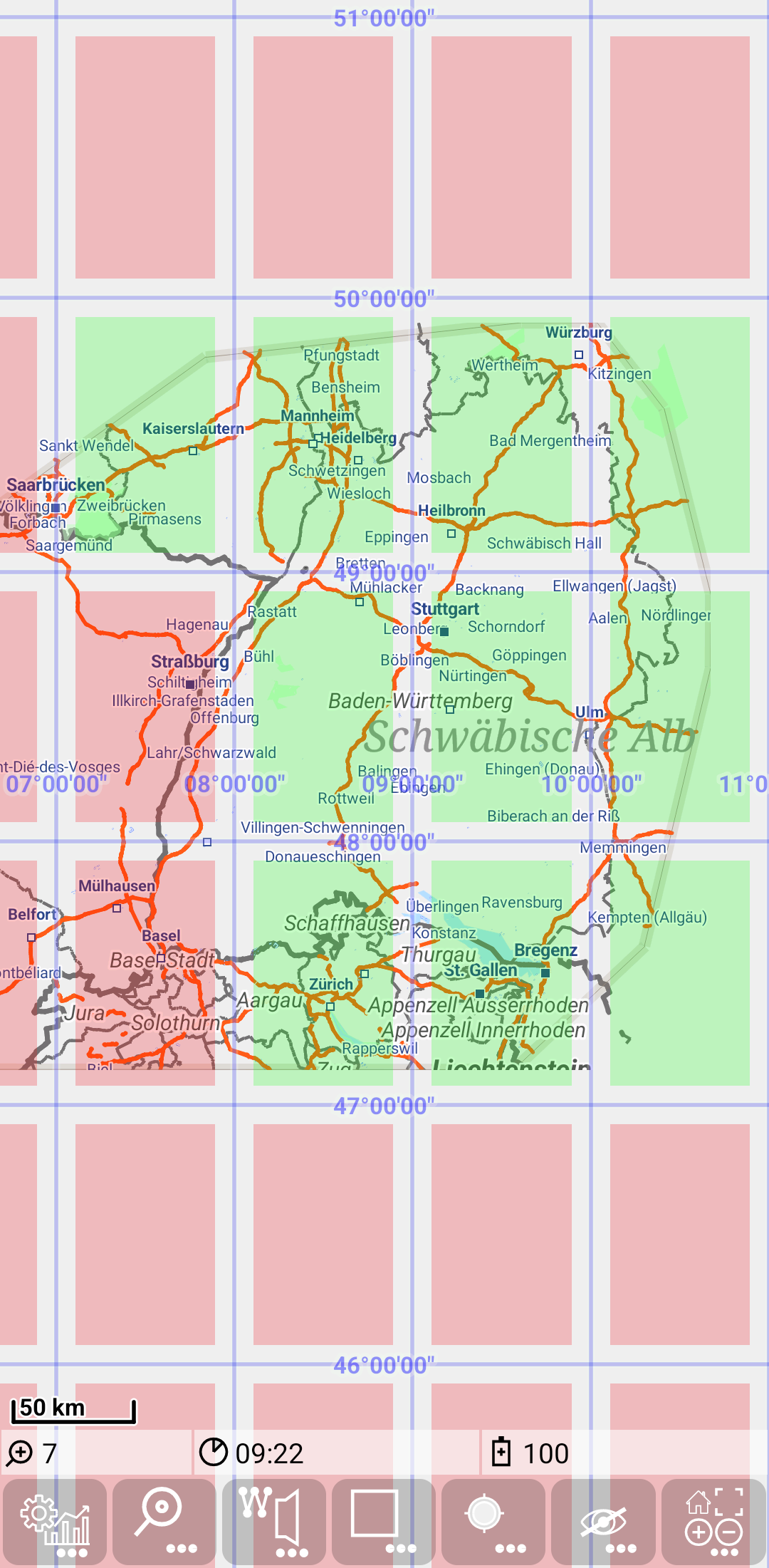
This layer is always available without configuration data. As other layers it allows to control transparency (as shwon in Overlay multiple map layers)
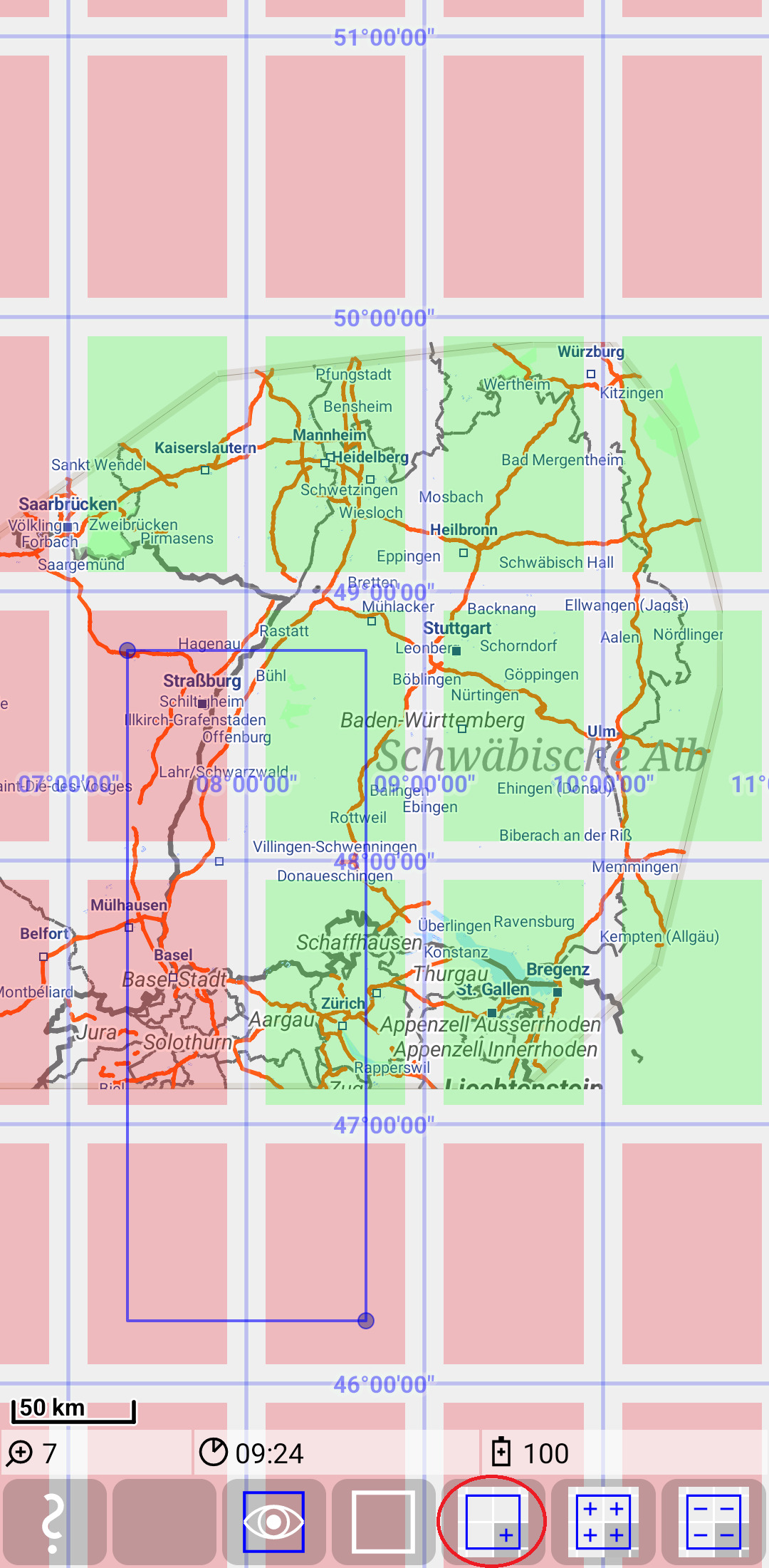
Downloading of missing hgt data
This feature supports easy download of missing hgt data. It works similar to the “Tile loading” section of the Bounding Box feature:
1) Switch on the bounding box mode with ![]() +
+ ![]() .
2) Mark relevant area (partly marked grid elements are included in loading)
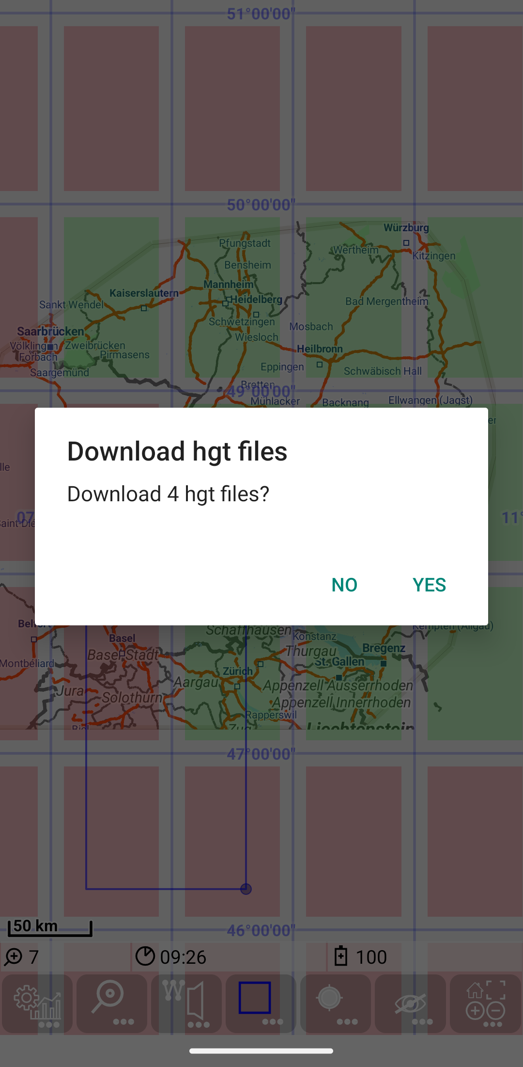
3) Use
.
2) Mark relevant area (partly marked grid elements are included in loading)
3) Use ![]() +
+ ![]() to load missing hgt files.
4) Confirm download dialog (for more information about the data source see height data)
5) Downloaded hgt data are visible in hgt layer
to load missing hgt files.
4) Confirm download dialog (for more information about the data source see height data)
5) Downloaded hgt data are visible in hgt layer
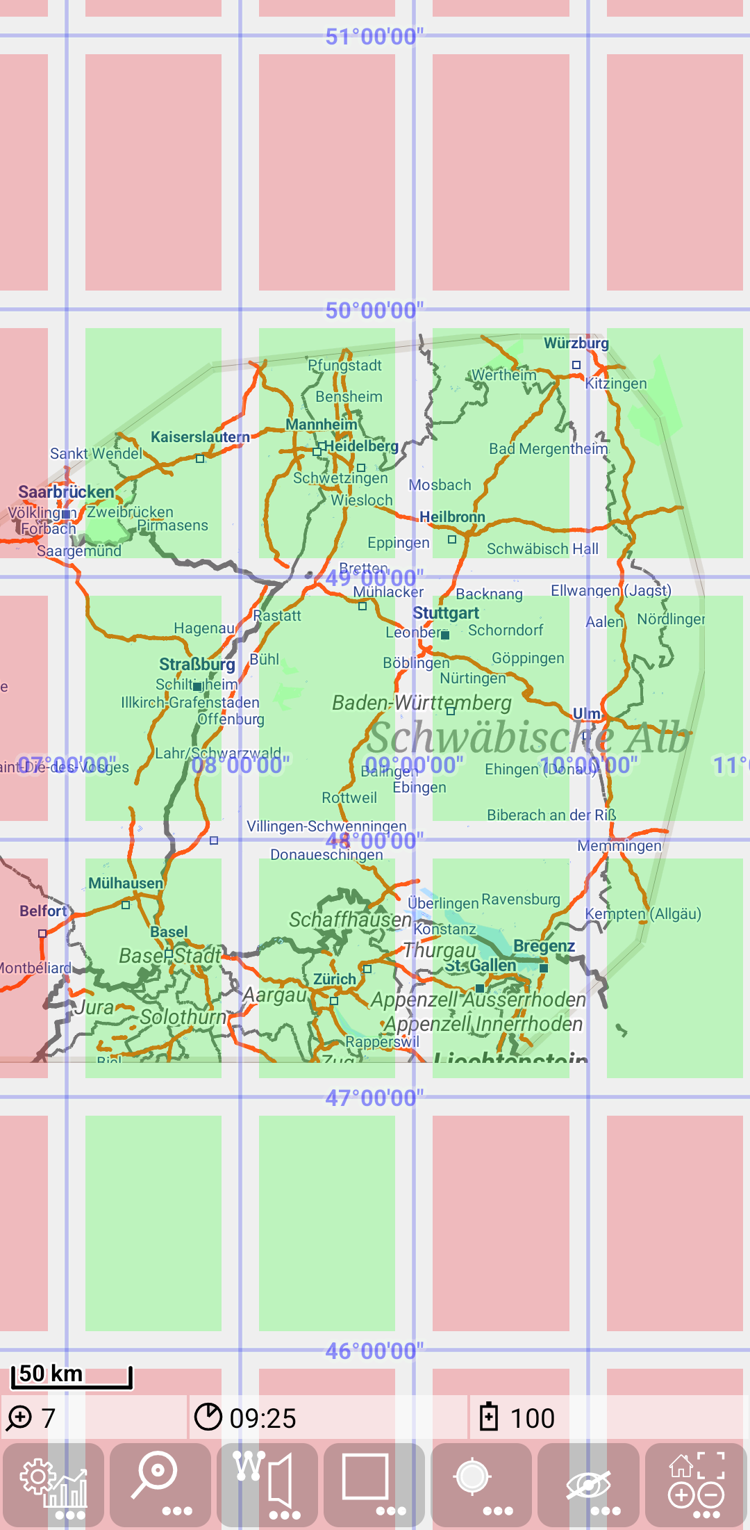
Be aware that loading includes all partly marked grid elements, while drop includes only fully included elements.